Lauterbrunnen, Jungfrau & Oeschinen Lake Hiking Guide : Top Trails, Itineraries & Tips
The Bernese Oberland delivers Switzerland’s most iconic alpine hiking: cascading waterfalls in Lauterbrunnen Valley, glacier-flanked ridges near Jungfrau, and the turquoise perfection of Oeschinen Lake. This complete Lauterbrunnen, Jungfrau & Oeschinen Lake hiking guide covers the top 5 trails, exact distances, elevation gains, transport connections, and 3-day itineraries. Whether you’re planning family-friendly walks or challenging ridge routes, you’ll find trail maps, seasonal tips, and budget breakdowns for hiking the Swiss Alps. Prime season runs June through September, with July-August offering the most reliable weather and snow-free high-altitude paths.
Best Places to Stay for Bernese Oberland Hiking 2026
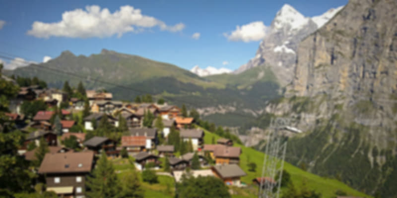
Interlaken (603m elevation): Central transport hub with frequent trains to all trailheads. Budget to mid-range hotels (CHF 120-250/night).
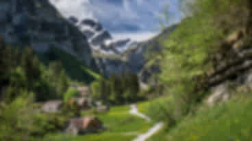
Lauterbrunnen (796m): Heart of the waterfall valley, 20 minutes from Interlaken. Direct access to Staubbach Falls and valley loops (CHF 100-200/night).
Mürren (1,638m): Car-free mountain village with panoramic views. Cable car access only. Alpine lodges (CHF 150-300/night).
Kandersteg (1,176m): Gateway to Oeschinensee, quieter than Interlaken. Family-friendly accommodation (CHF 110-220/night).
Trip Duration:
1 day for single highlights (Lauterbrunnen or Oeschinensee), 3 days for the classic triangle, 5+ days for comprehensive exploration with photography time.
Top 5 Bernese Oberland Hiking Trails: Distance, Duration & Difficulty
| Trail Name | Distance | Duration | Difficulty | Best For |
| Männlichen to Kleine Scheidegg | 4.5 km | 1.5-2 hours | Easy-Moderate | Families, panoramic views |
| Eiger Trail | 6 km | 2-3 hours | Moderate-Challenging | Close-up glacier views |
| Lauterbrunnen Valley Loop | 12 km | 4-5 hours | Easy-Moderate | Waterfalls, meadows |
| Oeschinensee Lake Circuit | 2 km | 30-45 min | Easy | All ages, photography |
| Mürren to Allmendhubel | 3 km | 1-1.5 hours | Easy-Moderate | Alpine meadows |
Detailed Hiking Trail Guides with GPS & Tips
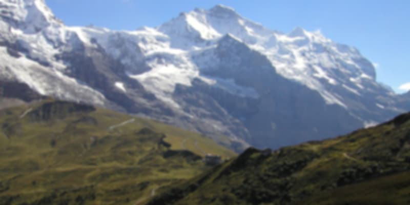
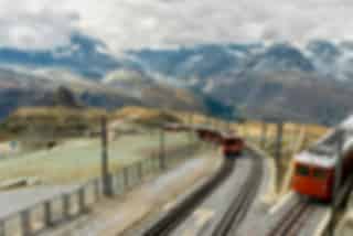
Männlichen to Kleine Scheidegg Walk
- Trailhead GPS: 46.6106°N, 7.9397°E (Männlichen cable car station)
- Highlights: Eiger, Mönch, Jungfrau mountain panorama
- Access: Cable car from Grindelwald (25 min) or Wengen (6 min)
- Best Time: 7-9 AM for sunrise colours, uncrowded paths
- Family-Friendly: Wide, well-maintained trail suitable for ages 6+
Eiger Trail (Eigergletscher to Alpiglen)
- Trailhead GPS: 46.5767°N, 7.9631°E (Eigergletscher station)
- Elevation: Starts at 2,320m, descends to 1,616m
- Terrain: Rocky, exposed sections with fixed ropes
- Footwear: Sturdy hiking boots are essential
- Crowds: Weekdays before 9 AM recommended
- Note: Snow possible through late June at higher sections
Lauterbrunnen Valley Loop Trail
- Starting Point: Lauterbrunnen train station (46.5933°N, 7.9075°E)
- Key Stops: Staubbach Falls (297m high), Trümmelbach Falls (glacial caves), meadow paths
- Surface: 60% paved, 40% gravel/grass
- Accessibility: Flat sections suitable for strollers near the village
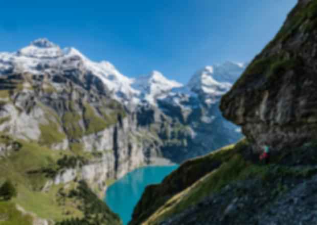
Oeschinensee Loop (Kandersteg)
- Lake GPS: 46.4989°N, 7.7261°E
- Access: Gondola from Kandersteg (8 min ride, CHF 32 round-trip)
- Water Temperature: 8-15°C June-September (swimming possible July-August)
- Facilities: Lakeside restaurant, boat rentals (CHF 20/hour)
- Extension Option: Heuberg ridge hike adds 2.5 hours, +400m elevation
Mürren to Allmendhubel Meadow Trail
- Funicular Access: 5 min from Mürren village
- Wildflowers: Peak bloom mid-June to early August
- Loop Options: 1-hour easy circuit or connect to Grütschalp (2.5 hours)
Transport & Access: Trains, Cable Cars & Schedules
From Zurich Airport to Interlaken:
Direct train 2.5 hours (CHF 66 each way, book via SBB.ch).
Key Connections:
- Interlaken Ost → Lauterbrunnen: Every 30 min, 19 min, CHF 7.40
- Lauterbrunnen → Mürren: Cable car + mountain train, 20 min total
- Interlaken → Kandersteg: Hourly trains, 55 min, CHF 17
- Grindelwald → Männlichen: Cable car every 30 min, CHF 34 one-way
Swiss Travel Pass Benefits:
Unlimited 2nd-class train travel, 50% discount on most mountain railways, free museum entry. Purchase online or at major stations.
Operating Hours (Summer):
Most gondolas 8 AM to 6 PM. Verify current schedules at myswitzerland.com/timetables before departure.
Hiking Season & Weather: Best Time to Visit
- June: Trails opening, snow above 2,000m, fewer crowds. Avg temp 12-20°C.
- July-August: Peak season, all trails accessible, warmest weather (15-25°C). Book accommodation 6-8 weeks ahead.
- September: Excellent hiking, autumn colours, cooler mornings (10-18°C), reduced crowds.
- Snow Risk: High-altitude trails (Eiger, Schilthorn approaches) may have snow patches until late June. Check myswitzerland.com/conditions.
- Weather Check: Mountain weather changes rapidly. Morning forecasts at meteoswiss.ch. Carry a waterproof shell regardless of the forecast.
Essential Hiking Gear for Lauterbrunnen, Jungfrau & Oeschinen Lake
Footwear & Clothing:
- Waterproof hiking boots (ankle support for Eiger Trail)
- Moisture-wicking layers (temperatures drop 6°C per 1,000m elevation)
- Windproof/waterproof jacket
Navigation & Safety:
- Offline trail maps (Swisstopo app, free download)
- Portable charger (10,000mAh minimum)
- First aid kit with blister treatment
- Headlamp (for early starts or emergencies)
Switzerland Tour Package Starting @ ₹89,412
Conclusion: Plan Your Bernese Oberland Hiking Adventure
The Lauterbrunnen, Jungfrau & Oeschinen Lake hiking delivers Switzerland’s most accessible alpine hiking, combining dramatic scenery with well-maintained trails and efficient transport. Prioritise the Männlichen panorama walk for effortless glacier views, the Eiger Trail for advanced hikers seeking close-up mountain drama, and Oeschinensee for family-friendly alpine lake beauty. Book accommodation by early May for July-August travel, purchase your Swiss Travel Pass before arrival, and download offline maps via Swisstopo. Start hikes between 7-9 AM to avoid crowds and capture optimal lighting. With proper planning, these iconic Swiss Alps trails deliver unforgettable hiking experiences for all fitness levels. Choose your next Switzerland tour packages with Pickyourtrail for customised itineraries as per your preference.
FAQ’s
Q: How difficult is the Eiger Trail for beginner hikers?
A: It’s moderate to challenging, with a 600m descent and rocky, exposed paths. Not ideal for first-timers. Try the Männlichen–Kleine Scheidegg route instead—similar views with easier terrain.
Q: Is the Swiss Travel Pass worth it for hiking in the Jungfrau region?
A: Yes, if hiking 3+ days. The 3-day pass (CHF 272) gives unlimited trains and 50% off lifts to Männlichen, Mürren, and Schilthorn. Without it, lift tickets can total CHF 150–200.
Q: Can I hike from Lauterbrunnen to Oeschinensee in one day?
A: No. There’s no direct trail. You’ll need trains via Interlaken to Kandersteg (about 2 hours each way). Visit on separate days or stay overnight in Kandersteg.
Q: What’s the best family-friendly hike with young kids (ages 4–8)?
A: The Oeschinensee Lake Circuit (2 km, 30 min) is perfect, flat, scenic, and has a playground and lakeside restaurant. For kids 6+, try Männlichen to Kleine Scheidegg for a moderate adventure.
Q: Where can I download trail maps and GPX files offline?
A: Use the Swisstopo app or download from schweizmobil.ch for free GPX files. Trails are well-marked with yellow signs showing destinations and times. Local tourist offices also provide printed maps.

Recommended articles for you


Discover Packages


Need help in planning?
Talk to our Travel Experts